OUTDOOR COMPETITION
![]() TEAM DRONEACHARYA: CREATION LABS – Vellore Institut of Technology
TEAM DRONEACHARYA: CREATION LABS – Vellore Institut of Technology
![]() AKAMAV – Technischen Universität Braunschweig
AKAMAV – Technischen Universität Braunschweig
![]() AUTMAV – Tehran Polytechnic
AUTMAV – Tehran Polytechnic
![]() BLACK BEE DRONES – Universidade Federal de Itajubá
BLACK BEE DRONES – Universidade Federal de Itajubá
![]() CIGOGNE – INSA Strasbourg
CIGOGNE – INSA Strasbourg
![]() FLY EAGLE – Beijing Institute of Technology
FLY EAGLE – Beijing Institute of Technology
![]() GUILANO – Lahijan Azad University
GUILANO – Lahijan Azad University
![]() INSTINCT COUGAR – National University of Singapore
INSTINCT COUGAR – National University of Singapore
![]() INSTINCT LION – National University of Singapore
INSTINCT LION – National University of Singapore
![]() LANCELOT – Beijing Institute of Technology
LANCELOT – Beijing Institute of Technology
![]() MECHATRONIX – Bialystok University of Technology
MECHATRONIX – Bialystok University of Technology
![]() QUETZALC++ – Instituto Nacional de Astrofísica, Óptica y Electrónica
QUETZALC++ – Instituto Nacional de Astrofísica, Óptica y Electrónica
![]() RMIT – RMIT University
RMIT – RMIT University
![]() SRC – Islamic azad university of Tabriz
SRC – Islamic azad university of Tabriz
![]() U.O.M. – University of Manchester
U.O.M. – University of Manchester
![]() VYOMA – Rashtreeya Vidyalaya College Of Engineering
VYOMA – Rashtreeya Vidyalaya College Of Engineering
![]() WHU DEEPFLYER – Wuhan University
WHU DEEPFLYER – Wuhan University
Due to the large numbers of entries received for the outdoor competition and the outdoor challenges (treasure hunt challenge, drone team parade), we are obliged to limit each team to a 15-min time slot (instead of 25 minutes as previously scheduled) for the outdoor competition, 5 minutes for the treasure hunt challenge and 5 minutes for the drone team parade.


- Automatic take-off
- a take-off is considered automatic as long as the safety pilot does not transmit any commands (except mission start signal)
- the MAV can be hand-launched.
- points are awarded for every MAV that performs at least one other mission element during its flight, except precision landing (taking off and landing is not enough to count as a valid mission flight)
- Flight performance
- fly as many laps as possible in the competition slot around 2 poles during a single flight (landing in the middle would reset the number of laps)
- begins when crossing the “start” line; only laps that have been completed count in the final score
- the MAV must land before the end of the allotted time to be valid
- flight altitude is only limited by the boundaries of the flight zone
- Mapping
- produce the map of the blue area on the map below, which include a small house and several storage places
- the garage of the house and one storage are opened and can be inspected as well
- Target detection and recognition
- search and identify targets (hazardous materials or missing people) outside and inside the house’s garage or the storage places (storages are numbered S1, S2 and S3 as shown on the map below, not all of them have targets in front, only one storage is opened)
- targets can be located on the map produced by the team (see previous mission element) or a rough map provided by the organizers
- Cooperative carrying
- at least 2 drones should carry a weight over a distance of 50 meters
- attaching the MAVs to the weight can be done by team members, no autonomous grasping are required
- 2 objects of different weight can be chosen by the teams
- Precision landing
- a landing will be classified as one of the following: a field landing, a normal landing, or a precision landing
- the size and place of each landing zone (normal/precision) depends of the type of MAV (fixed-wing, VTOL)
- in case of rough landing, the team will be asked to demonstrate the airworthiness of the vehicle
- extra points are awarded if the MAV is able to take-off again (fly higher than 5m) after staying still 10 seconds on the ground and without any operator intervention
- all MAVs must land within the time slot, otherwise all mission elements since last take-off will be discarded for this MAV

| Mission elements | Mission score |
|---|---|
| Automatic take-off | 1 |
| Flight performance | number of laps / 8 |
| Mapping | 2 for automatic processing (2D or 3D map, can be done off-line but within mission time) +1 for images from inside the house’s garage +2 for images from inside the opened storage |
| Target detection | 1 for clear view of the target 1 for automatic detection and classification of the target 1 for correct location on the map |
| Cooperative carrying | 1 per MAV involved if the minimum distance is reached x3 bonus when using the heavy payload +1 for precision landing of the carried weight |
| Landing (precision/normal/field) | 2, 1, 0 extra points: +1 by taking off after 10 seconds staying still without any operator assistance |


The doors of the storage is about 3.5 x 3.5 meters. As an old military shelter, the walls are very thick and could make communication difficult while attempting to fly inside.

Target to be identified and located on the map : 40 cm-diameter red pot
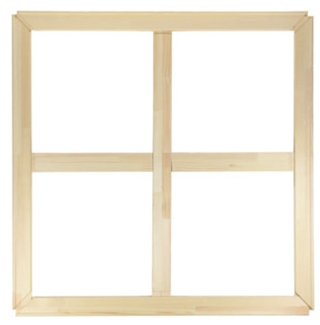
1 meter x 1 meter wooden frame to be carried by at least 2 drones for the cooperative flight. The mass is 2.1 kg and a ring will be attached to either vertex.
A lighter plastic frame that can be used with small micro-drones is being fabricated with the same size 1 meter x 1 meter and a final weight between 400 and 500 grams. A bonus on the mission point will be applied when using the heavy wood frame. A photograph will be posted soon.
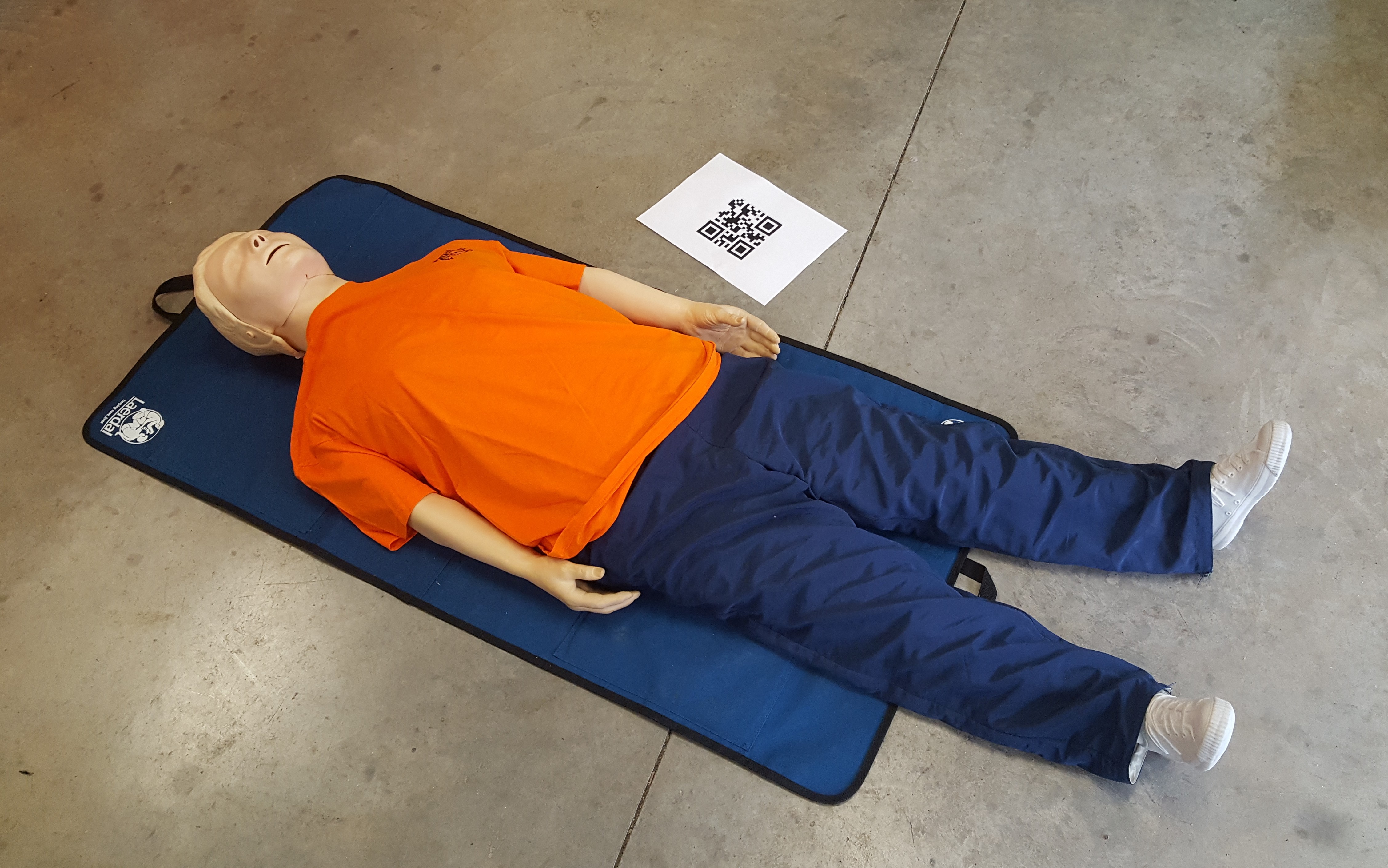
Dummy in lying position
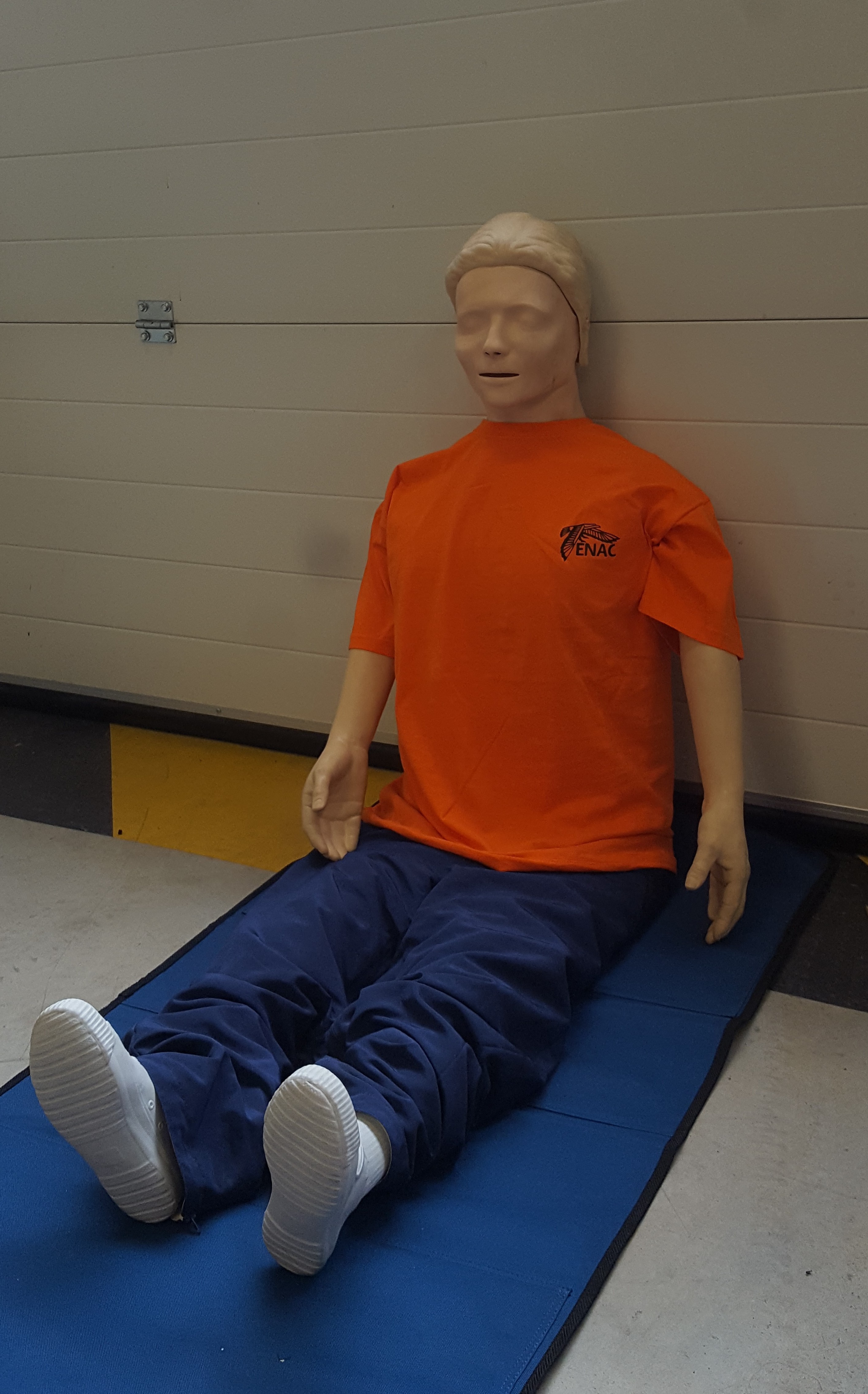
Dummy in sitting position
Special challenges
Treasure hunt challenge
In this outdoor challenge, the goal is to find hand-made objects which are not visible using a video camera. More precisely, 4 disks will be placed horizontally on the grass within a 15×15-meter square area. Each disk is 40-cm diameter and 4-cm thick. It will be painted with camouflage-colour so as to be almost impossible to detect through a video camera. Three disks will be made of foam and one disk will be made of steel (40 kg). The objective is to locate the maximum number of disks by providing (X,Y) coordinates in meters with respect to the lower left corner of the square area. A maximum of 4 locations will be provided per team. Each correct location provides 1 point. “Correct location” means that the X,Y coordinates are provided with an uncertainty of less than 30 cm. Identification of the metallic disk provides 3 points.
The challenge will be evaluated according to the following criteria:
- flight autonomy
- autonomous calculation of locations
- duration of the hunt
- efficiency of the path planning

Drone team parade trophy
In this challenge, the goal is to have a patrol of UAVs (fixed-wing, rotorcraft or mixed) flying in a formation so as to demonstrate their coordination and flight accuracy skills.
This challenge will be evaluated according to the following criteria :
- accuracy of the formation shape and number of UAVs involved
- accuracy of the path followed by the UAVs
- aesthetic qualities of the formation
- elapsed time necessary to reach the formation configuration